SoCal Six-Packs of Peaks challenge #4 “San Bernardino Peak”
ATTENTION: Special Events are different than our regular club runs and are for current club members only!

SAN BERNARDINO PEAK – Elevation 10,649′ (3,246m)
What you need to bring:
– Adventure Pass for parking your car. (Same adventure pass we use for Chantry & Baldy. Year pass is $30 or a day pass is $5, available at REI and Big5.
– Hydration backpack with a minimum of 3 liter water, snacks, sun hat, extra layer in case of emergency, everything else you might need on a mountain adventure that’ll take a couple hours taking the weather conditions in consideration.
The trailhead parking requires an Adventure Pass. More info here
Free Wilderness permits are NOT required for day hikes. More info here
The first challenge is the extra long drive. So this club-members-only event will require a RSVP, with the possibility of setting up a carpool.
The second challenge with this hike is finding the trailhead. The key is to look for the fire station (it’s on Manzanita). Turn towards the station, then an immediate left on the frontage road. That’s where you’ll see what might be the most detailed road sign I’ve ever seen. We will start from here and not take the 1/4 mile bumpy road to the start of the trail head.
The third challenge is the hike itself:
“San Bernardino Pk.” tops out at a respectable 10,649 feet. “San Bernardino East Pk.” tops at 10,691 but adds on about 1 mile (2 mile roundtrip). Hiking/running from Angelus Oaks, this 16+ mile out and back course climbs over 4,600 vertical feet.
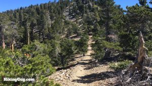
There are three distinct sections to this trail. The first section climbs steadily up well-engineered switchbacks through oak and pine forest. You gain a lot of elevation quickly, but the trail is smooth and not too steep, with the great views out toward the Inland Empire and north towards the snow-capped Mt. San Antonio (aka Baldy).
Eventually you emerge at Manzanita Flats — the main junction along this trail. Note: read the trail signs, and head toward Limber Pines.
The second section gently climbs through manzanita, with beautiful views to the north towards Big Bear. The trail beings to climb up the final slope as you near Limber Pines. There is a small seasonal creek that you’ll cross about 1/2 mile before Limber Pines.Limber Pines is where the weekend backpackers often setup camp, and it makes a great place for a break before your final climb.
The third and final section follows switchbacks up the steep slope to Washington’s Monument, then parallels the ridge to the top of San Bernardino Peak.Washington’s Monument is the tongue-in-cheek name for a what is really little more than a pile of rocks with a pole stuck in the middle. In 1852, Colonel Henry Washington and his Army survey party were directed to erect a monument atop San Bernardino Peak. The monument was the east-west reference point from which all future surveys of Southern California were taken.
From Washington’s Monument, the trail follows the ridge for another 3/4 mile to the summit, where you can take in the 360 degree views.
Then we return to the cars.
More info about the Six-Pack Challenge
More info and photos on SoCal hiker
Trail Runners Club Strava map and elevation

